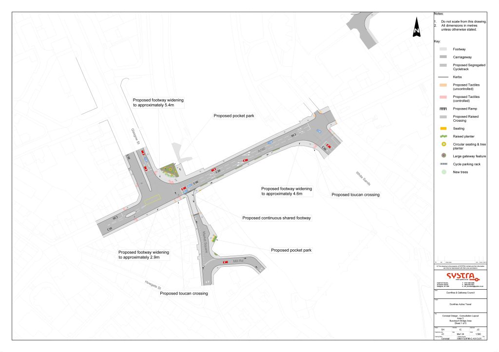
This scheme opens up an old route that used to exist; a continuation of College Street into Market Square. The end of College Street became a car park, the barriers went up and crossing at the Maxwelltown side of the Buccleuch street bridge became a series of crossings back over Glasgow Street that take 5 minutes or in some cases a dangerous hop over the barriers and a scamper across 4 lanes of traffic. Not ideal to put it mildly.
View plans and the online survey form | Jump directly to the survey form (reply before December 16)
This post will be short as it’s a very compact scheme and I’ve covered many of the principles in other posts.
First let’s look at the plan. From this view the most obvious change is the introduction of a crossing re-joining College Street to Market Square. There’s some public realm improvement around Market Sqaure as well, a better entrance to the Greensands and a widening of the pavement at the Whitesands side where people congregate to cross. Crossing should be quicker as the crossing over the Whitesands is changes to a single phase crossing rather than one with a refuge in the middle.
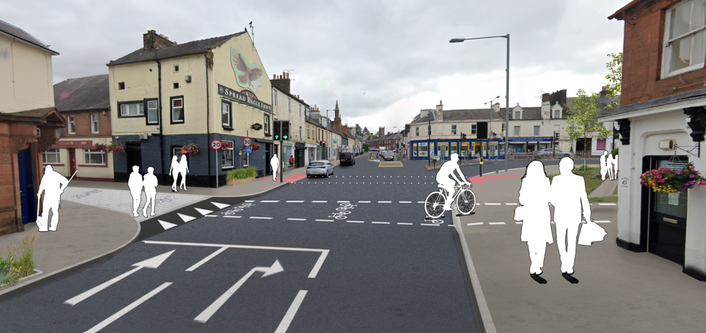
When you look at the visualisation in the coming paragraphs, you’ll that the barriers have been removed and what a different this makes in terms of what can be achieved.

It’s quite a small scheme, but it would make cycling between Lochside, Lincluden and Sandside and the D&G College, UWS, Mountainhall and the Crichton almost off road all the way by using the Troqueer river path, KM bridge and Castledykes park.
There’s also a helpful visualisation that really helps get across what’s planned here.
The removal of the barriers is obvious for anyone that knows the area well. This enables people to flow North/South again more quickly. As we see in other schemes, congestion at crossings is reduced by having a separate crossing for bike users and for pedestrians.

View plans and the online survey form | Jump directly to the survey form (reply before December 16)
