I’m going to combine several pieces of the Better Streets schemes into one route (with a branch into town) because it helps illustrate some of the thinking behind the project.
View plans and the online survey form | Jump directly to the survey form (reply before December 16)
This is the longest continuous route and it stretches from the Cornwall Mount roundabout at the bottom of Annan Road, past the railway station, crosses over Lovers’ Walk to Newall Terrace, through the Council HQ carpark, across English Street on to Shakespeare Street to the river paths at Nith Place. I mentioned branches. There’s a branch that continues along Newall Terrace, past the Council HQ car park and on to the top of Great King Street / Loreburn Street. This is considered to be the optimal route between the railway station and the town centre. As Shakespeare Street connects to the High Street and Irish Street ( but as a one way ) then we can also consider those branches, but they are covered in a separate article.
So what principles does this route showcase? Let’s walk the route and look at each one.
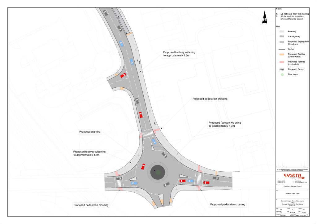
First we can see that crossings are introduced at each arm of the roundabout with tactile surfaces and dropped kerbs to improve accessibility. This ensures minimal disruption for people walking or wheeling to or from the Annan Road. Given the close proximity to the railway station, DGOne, The Range and Morrisons this should encourage more people to walk or wheel to these amenities. Roundabouts of this size on A roads are one of the main challenges for cyclists and put off many people from using a bike in town. This scheme creates bypass options for less experienced or less confident bike users. The pavements have been widened to make shared use paths and where sufficient space is available (top of picture) pedestrians and bike users are separated and a 2 way cycleway implemented.
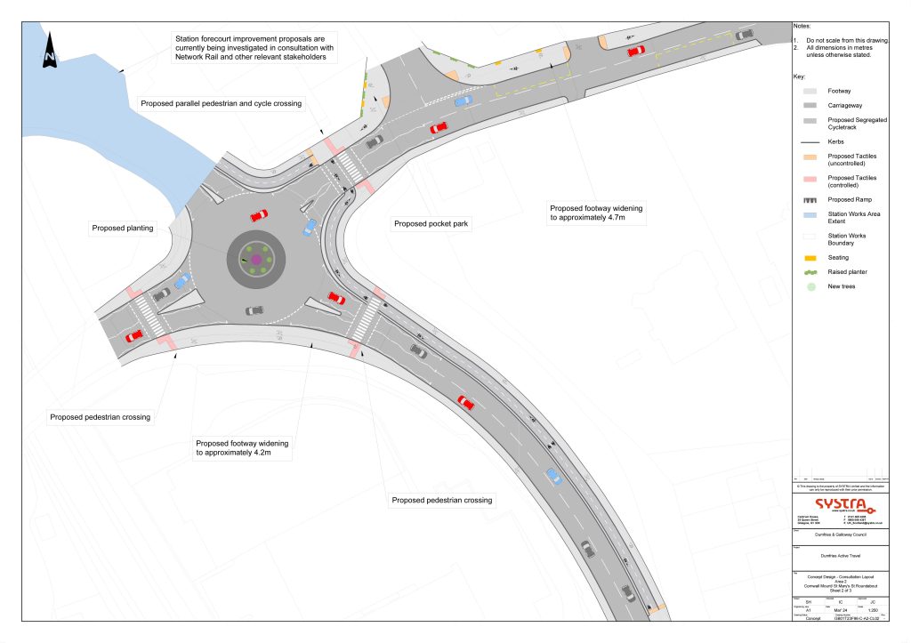
The same principles are employed as we progress along Cornwall Mount to St Mary’s Street and another large roundabout. Pedestrians and wheelers are served with good crossing positions and bike users can by pass the roundabout and get access to the railway station or rejoin the road safely to continue into town over the bridge. For people going to the High School, the new shared path created (along the top of the picture) connects to the quiet road route to the High School via Huntingdon Road and Avenue.
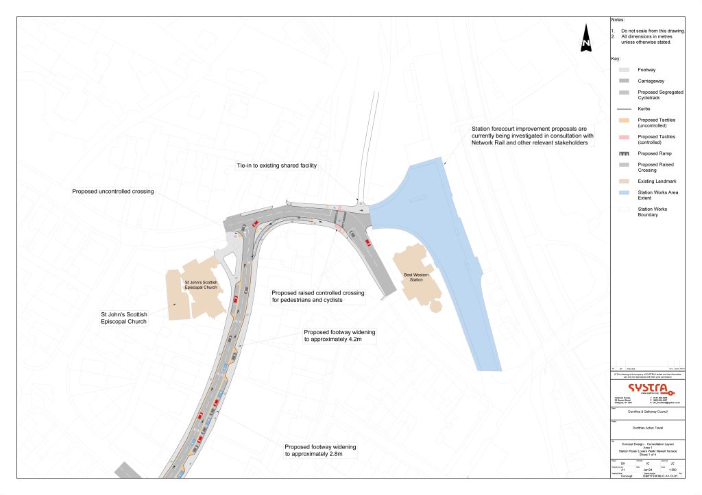
For those heading into town they will be able to go via the station car park on the ticket side of the station and benefit from a new crossing over Lovers’ Walk on a very dangerous corner. Good wayfinding measures will ensure that visitors to town can easily find the town centre from the railway station. The optimal route is along Newall Terrace then over to Great King Street or Munches Street delivering people directly on to the High Street.
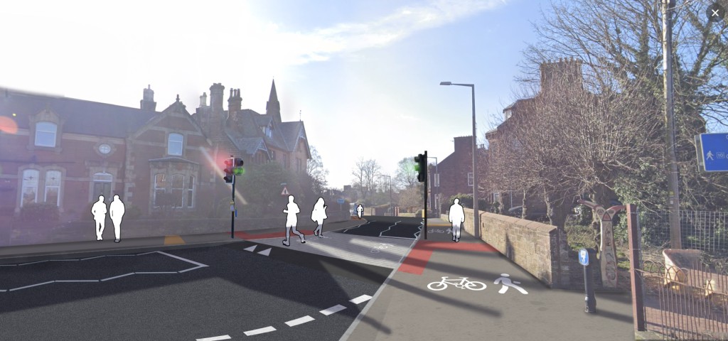
A new crossing at Lovers’ Walk
For people travelling further, particularly bike users or people that use wheelchairs or mobility scooters, a new route via the Council HQ would open up English Street and Shakespeare Street. This could deliver people to the High Street by the Loreburn Centre, Brooms Road car park or on to the Whitesands path with its connections to Mountainhall, The Crichton, University of West Scotland, D&G College or out west to DGRI along the Maxwelltown path.
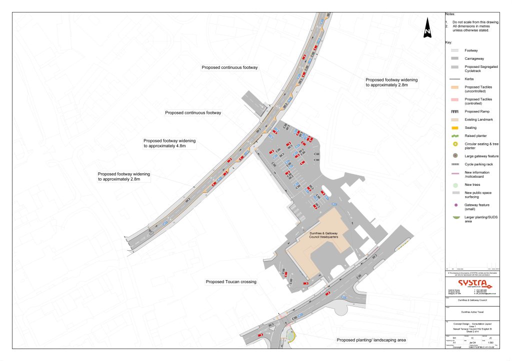
On to Shakespeare Street where some of the most ambitious work is proposed.
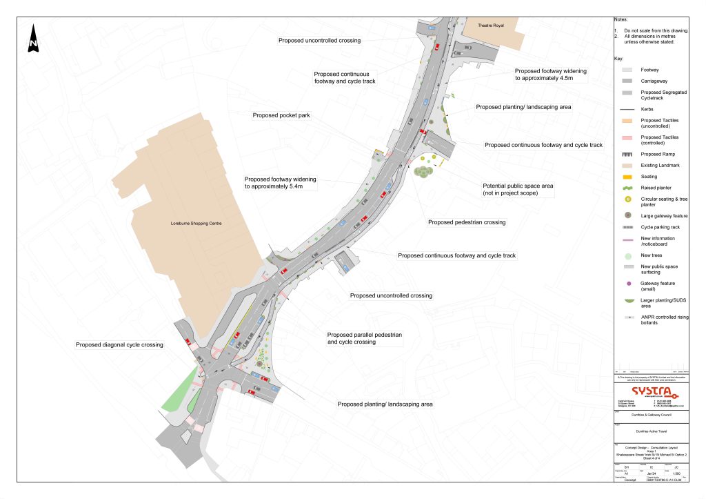
Shakespeare Street sits between an underused car park on Brooms Road and the town centre. In places it is 4 lanes wide and acts as a barrier to people flowing in and out of the town centre. At the moment it just funnels cars out of the town centre. But it has enough extra space to provide space for slower means of getting around town. Widened pavements, crossing, a two way cycleway along the full length of Shakespeare Street are proposed.
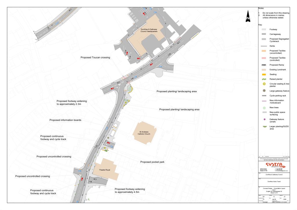
If you look closely at the plans, the pavement is widened considerably on both sides of the road and there’s a section of new tree planting along the side of the old NCP car park. Access is still maintained if the car park were ever to come back into use or take on a new role, but the mishmash of narrow pavements is improved and a continuous pavement at one level put in place making it easier for people that use wheelchairs or are even just less steady on their feet to use this route into town.
Love it? Hate it? Let us know by filling out the survey.
View plans and the online survey form | Jump directly to the survey form (reply before December 16)
